About All Tours From Bangkok ToursBoat Cruise ToursBike ToursDay Trip ToursPrivate Tours Directions Hours & Fees
Find Tours 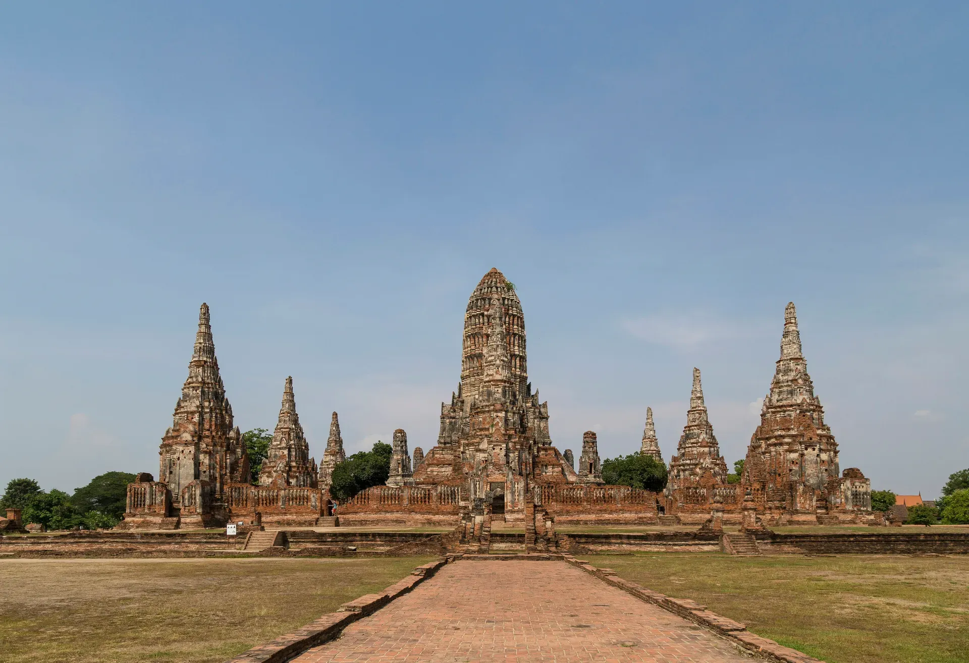
Ayutthaya is a 289-hectare archaeological park 80 kilometers north of Bangkok containing the ruins of Siam's former capital. Three rivers surround the island, where 15th-century stone temples and 35-meter reliquary towers stand exposed to the elements.
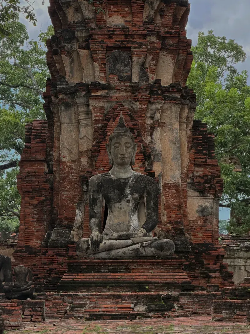
Ayutthaya occupies a man-made island at the confluence of the Chao Phraya, Pa Sak, and Lopburi rivers. The 289-hectare archaeological site contains the fragmented remains of Siam's second capital. Visitors walk among hundreds of exposed brick foundations, bell-shaped chedis, and headless Buddha statues. The modern city of Ayutthaya intertwines directly with the historical park. Paved roads cut through ancient temple complexes, and modern traffic flows past 15th-century walls. The Fine Arts Department manages the ruins, maintaining the grounds while leaving the battle scars from the 18th century visible. The park sits at an elevation of just 10 meters above sea level, making the surrounding waterways a defining feature of the landscape. Long-tail boats navigate these rivers daily, offering a perimeter view of the fortified island.
Temperatures routinely exceed 35°C on the island. Shade is scarce. The brick pathways absorb and radiate the midday heat, making exploration physically demanding between noon and 3:00 PM. Heavy rains in September and October frequently swell the three surrounding rivers, causing localized flooding that can temporarily close waterside ruins like Wat Chaiwatthanaram. Check the Fine Arts Department website for closure notices during the monsoon season. Stray dogs roam the open grassy areas; they generally ignore visitors but should not be approached or fed.
Getting to the island requires an 80-kilometer journey north from Bangkok. Trains depart from Krung Thep Aphiwat Central Terminal, taking 60 to 90 minutes. Third-class fan seats cost 20 THB and offer open windows for cross-breeze. Minivans from Mo Chit New Van Terminal charge 70 to 100 THB and drop passengers directly among the central ruins. Renting a bicycle for 50 THB near the train station provides the most efficient way to navigate the flat, sprawling park. A short 10-THB ferry ride carries cyclists across the river into the historical core. Tuk-tuks wait near the major temples, charging roughly 200 to 300 THB per hour for those who prefer motorized transport.
King Ramathibodi I established Ayutthaya on March 4, 1351. The strategic location at the junction of three rivers provided a natural moat and connected the city to the Gulf of Thailand. This geography allowed the settlement to control maritime trade routes between India and China. Over the next four centuries, 33 successive kings expanded the city's footprint. The population swelled to roughly 1,000,000 residents by the early 1700s. Foreign merchants, diplomats, and mercenaries established distinct enclaves outside the city walls. Japanese, Dutch, Portuguese, and French settlements operated under royal permission. The Dutch East India Company (VOC) built a massive brick headquarters on the riverbank, trading Siamese deer hides and ray skins for Japanese silver.
The Burmese army breached the city walls in April 1767 after a brutal 14-month siege. Invading forces used cannons to bombard the defenses and dug tunnels to undermine the brick fortifications. Once inside, soldiers looted the royal treasury, melted down gold-leafed Buddha statues, and set fire to the wooden structures. The wooden roofs of the grand temples collapsed, leaving only the stone and brick foundations. Thousands of citizens were captured and marched to Burma as prisoners of war. The total destruction forced the surviving Siamese leadership to abandon the site entirely. They relocated the capital 80 kilometers south to Thonburi, and eventually across the river to Bangkok. The once-massive urban center sat empty, its canals choking with debris and ash.
The jungle reclaimed the ruins for over a century. King Rama V initiated early conservation efforts in the late 19th century to clear the overgrowth and stabilize the largest monuments. The Thai government established the Ayutthaya Historical Park in 1976, formally mapping the 289-hectare core. UNESCO designated the site a World Heritage property in 1991, recognizing its architectural evolution. Today, restoration focuses on stabilizing the crumbling brickwork rather than rebuilding the structures to their original state. Visitors can descend into the excavated crypt at Wat Ratchaburana to view original 15th-century murals. Looters discovered this crypt in 1957, stealing thousands of gold artifacts before authorities secured the site. Police recovered a fraction of the stolen hoard, which now sits in the local museum. The Fine Arts Department continues to monitor the structural integrity of the remaining towers, using steel bands to prevent further collapse.
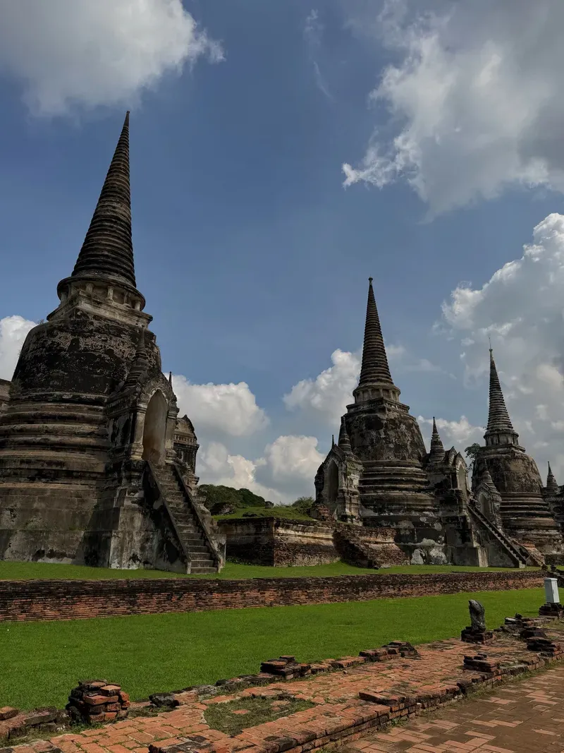
Red brick and laterite stone form the structural backbone of Ayutthaya's surviving monuments. The city's builders originally coated these rough materials in smooth stucco, though centuries of monsoon rain have washed most of it away. Three massive bell-shaped chedis dominate the skyline at Wat Phra Si Sanphet. These structures once held the ashes of three Siamese kings. Their wide bases taper into sharp spires, demonstrating the classic Ceylonese architectural influence adopted by the kingdom. The temple served exclusively as the royal family's private chapel, meaning no monks resided on the premises.
Khmer design elements define the riverside complex of Wat Chaiwatthanaram. A 35-meter central prang—a towering, corn-cob-shaped reliquary—stands surrounded by four smaller prangs and eight chapels. Steep, narrow staircases lead up the sides of the central tower, though modern safety regulations prohibit visitors from climbing them. Across the island at Wat Lokayasutharam, a 42-meter-long reclining Buddha rests entirely in the open air. Devotees regularly drape the brick-and-stucco figure in a massive saffron-colored cloth. The statue's head rests on a lotus-shaped pillow, facing east toward the rising sun.
Nature has physically integrated with the architecture at Wat Mahathat. The roots of a mature banyan tree have grown around a severed sandstone Buddha head. These wooden tendrils hold the face perfectly upright, roughly 50 centimeters off the ground. Park rules require visitors to kneel or sit when photographing this specific artifact to ensure their heads remain lower than the Buddha's. A short walk from this tree reveals the shattered remains of the temple's main 46-meter prang, which collapsed in 1911 due to structural neglect and heavy rains.
Wat Ratchaburana offers a rare look at the interior design of these monuments. A steep, narrow metal staircase allows visitors to descend into the main prang's crypt. The cramped underground chamber features faded 15th-century frescoes depicting past Buddhas and celestial beings. The air inside the crypt is stagnant and heavily humid, retaining the heat of the day. Exiting the crypt requires climbing back up the same narrow steps, often requiring visitors to wait for others to pass.
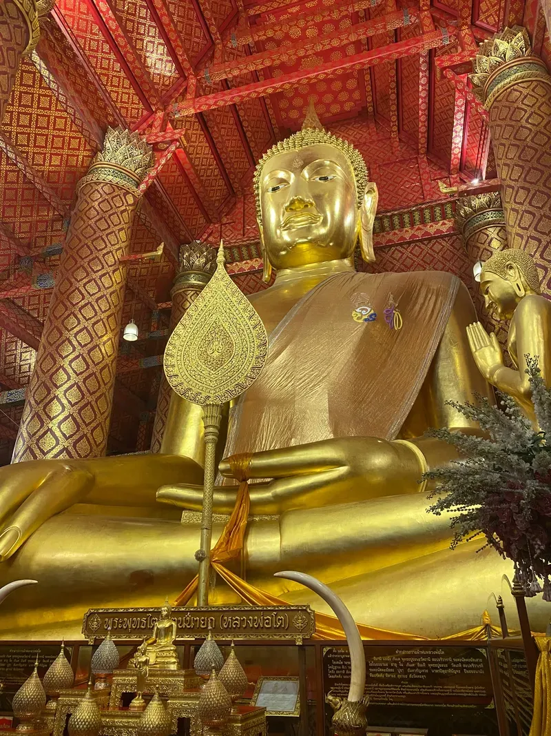
Ayutthaya functions as an active site of Buddhist worship despite its ruined state. Locals visit the fragmented statues to light incense, offer lotus flowers, and apply gold leaf to the stone surfaces. The grounds are legally protected by the Fine Arts Department, but they remain sacred space under Thai law and custom. Visitors must remove their shoes before stepping into any surviving chapel enclosures or approaching active shrines. Monks from nearby active monasteries frequently walk through the historical park, their bright orange robes contrasting against the faded brick.
Strict dress codes enforce this religious reverence. Guards at the entrance of major temples turn away individuals wearing sleeveless shirts, short shorts, or revealing clothing. Sarong rental stalls operate outside the main gates for 20 THB. The site also falls under Thailand's strict Lèse-majesté laws, as the ruins represent the historical seat of the monarchy. Disrespecting the royal legacy, climbing on the monuments, or removing rocks carries severe legal penalties. Signs throughout the park remind tourists not to sit on decapitated Buddha statues for photographs.
The city's layout continues to influence modern Thai urban planning. When King Rama I established Bangkok, his architects explicitly copied Ayutthaya's grid, riverine orientation, and temple placement to legitimize the new capital. The Chao Sam Phraya National Museum, located 5 minutes from the main ruins, houses the surviving gold artifacts and royal regalia salvaged from the ashes. This facility displays the intricate gold swords, royal crowns, and jeweled elephants recovered from the crypts, keeping the material culture of the 33 kings intact for public viewing. During the annual Loy Krathong festival in November, locals gather along the rivers surrounding the historical park to float small banana-leaf baskets carrying candles. The candlelight illuminates the ancient walls from the water, temporarily merging the modern religious practice with the 14th-century foundations.
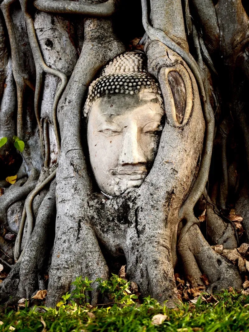
The famous sandstone Buddha head at Wat Mahathat was likely left on the ground by looters before a banyan tree grew around it over several decades.
Builders used a traditional mortar made from palm sugar, sand, and animal hide to bind the bricks of the massive bell-shaped chedis.
The city's island geography is artificial; early settlers dug a canal to connect the three surrounding rivers and form a defensive water barrier.
The entrance fee is 80 THB per major temple, but a combined pass covering seven key sites costs 300 THB at the main park office.
Flying a recreational drone over the ruins requires written permission from the Fine Arts Department and registration with the Civil Aviation Authority of Thailand.
Bicycles cost roughly 50 THB to rent for the day and remain the primary mode of transport for navigating the flat 289-hectare park.
Heavy monsoon rains in October frequently cause the surrounding rivers to overflow, submerging the lower levels of riverside temples like Wat Chaiwatthanaram.
Yes. The historical park is 80 kilometers north of Bangkok. Trains and minivans make the journey in 60 to 90 minutes.
Shoulders and knees must be covered at all times. Sleeveless tops and short shorts are strictly prohibited, though sarongs are available to rent at temple entrances.
Individual major sites charge an 80 THB entrance fee. A combined pass covering seven key temples is available for 300 THB.
Renting a bicycle for 40 to 60 THB per day is the most efficient method. Visitors can also hire a tuk-tuk for 200 to 300 THB per hour.
The sandstone Buddha head entwined in banyan roots is located at Wat Mahathat, near the center of the historical island.
Accessibility is mixed. Wat Mahathat and the Reclining Buddha have relatively smooth paths, but most ruins feature steep stairs, high curbs, and uneven brick terrain.
No advance booking is required. Tickets are sold directly at the entrance gates of each individual temple or at the main park office.
The park remains open, but heavy rains in September and October often cause localized flooding. Riverside sites like Wat Chaiwatthanaram may close temporarily if water levels rise.
Recreational drone use is strictly prohibited. Operators must obtain written authorization from the Fine Arts Department and register with Thai aviation authorities.
A standard day trip lasts 6 to 9 hours, which covers the main highlights. Spending two days allows for a slower pace during the intense midday heat.
Browse verified tours with free cancellation and instant confirmation.
Find Tours